

News
Membership info.
Event Calender
Publications and Trip Reports
Photo Gallery
Tararua Huts
Club Communication
Tramping and Climbing Links
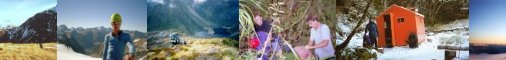
Under the Mistletoe – Christmas in the Ohau/Landsborough
Shoulders hunched and heads down we tug our jacket hoods over our faces to block out the stinging rain, another huge wind gust booms in and we stagger as it hits us, around us the mountains are completely hidden. “So far I’m not finding this trip very inspiring” Quentin remarks.
No we weren’t on the Tararua tops, rather we were trudging up the washed out Hopkins Valley road towards Monument Hut and the start of our 2003 Christmas Trip.
Earlier in the day we had sat in Twizel, underneath a huge nor’west arch looking at the thick rain cloud at the head of Pukaki. We had a cunning plan, to stay (mostly) east of the divide and hopefully stay dry, but the fallacy of this was quickly brought home as we struggled into boots and gaiters where Hopkins road ends at Huxley Lodge. Our plan had been to head to Elcho Hut that night, but the strong wind roaring down the valley had us considering stopping at tidy Monument Hut after just a couple of hours. We compromised and turned into the Huxley Valley which shielded us from some of the weather. The Huxley was very pleasant tramping, even in the rain, and one of the highlights was Hannah seeing Mohua or Yellowhead, an extremely rare native bird. Huxley Forks is a wonderful hut, and we arrived at 8pm, quickly had a hot fire going and made the Wellington mountain radio sched.
The next morning dawned windy and grey, but dry and we headed up the North Huxley to Brodrick Hut. The awesome power of nature was visible in the numerous avalanche paths that we crossed, many still clogged with debris. After an early lunch to fuel up, we crossed a huge avalanche that had crashed off Mt Strauchon and began the climb up to Brodrick Pass. This proved to be slow but steady work with heavy packs, initially through scrub, then tussock and rocky ribs. The last section was still snowbound and we traversed carefully but quickly around the head of the stream at G37 468887, and bulldozed up through the lowest snow-drift to the actual pass. The strong wind had scoured out the snow on the western side and piled it up on the edge. There was still a strong, cold wind on top so we quickly descended into the upper basin of McKenzie Creek and headed for the Landsborough Valley. This proved to be slower travel than it looks on the map, though I knew of a campsite above a prominent slip just inside the bushline so we weren’t too worried. Not getting down to the Landsborough that night turned out to be a blessing in disguise as the campsite was superb, and the top of the slip offered magnificent views of the rapidly clearing Mt Hooker and Mt Dechen as well as the rolling tussock of the Solution Range. Classic tramping country in there.
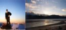
We were treated to an amazing sight as we awoke early the next morning and climbed to the crest of the spur. Before us the whole Landsborough Valley was filled with cloud, while the peaks from Shattered Peak and Weary Summit in the south to Fettes in the north, reached above luminescent with their alpenglow. It was one of the better views I have had tramping, really quite stunning. The spur offered superb travel down, and although the last section down the stream was a little slower, we soon popped out just downstream from Cresswicke Flat and wandered up to Fraser Hut for morning tea. The rest of the day turned out to be a hot boulder hop down the true left of the mighty Landsborough river, with just a couple of annoying sidles where the river had cut in. For the most part the river appears to roll rather than rush down here. It’s big, blue and fast, yet in many places it slid by with just a gentle lapping of waves on big rocks. The din around some of the larger rapids was quite a contrast. It would be awe-inspiring yet terrifying in flood. We camped in a secluded glade about ten minutes from the base of Harper Bluff, and in the tent at dusk we listened as a South Westland stag barked and prowled the edge of the forest. It was hot and dry, but the radio was warning us of westerly rain and lots of it.
We awoke to a heavy sticky sky, and as we shouldered packs and headed for Harper Bluff it began to rain. The bluff was easy to cross, following instructions in Moirs (I would recommend boulder hopping to the base of the climb rather than sidling up to the base of the bluffs), and we plunged down through mossy, wet bush to Harper Flat. Another stag was barking and rubbing against trees at the bush edge here and we skirted wide around it. We found a deserted campsite – perhaps belonging to the Arawhata Bill style character that the Fraser Hut logbook reports as living in this area. From the McLennan creek confluence we began the long climb out of the Landsborough. Initially we bashed through crown fern and dripping mossy forest before the hitting the spur proper where travel opened up. It was consistently steep the whole way up to spot height 1174 where tight bush twists around chaotically stacked boulders and crevices. From here we could see into the tussock basin of McLennan creek (only about 600m away as the Kea flies). As we took on some food and drink a loud crack of rock-fall startled us, and we could clearly see the big boulders booming into the mist filled Border Creek.
The sidle looked unpleasant on the map and it was. Steep leatherwood, dracophyllum and moutain beech was tangled around slabs, bluffs, big boulders and bush lawyer infested windfalls. We slid and slithered down and tried to move up valley when we could. Our ice axes and crampons snagged continuously and in the rain it was cold slow, and slippery. After a while the gradient levelled off and the forest opened up and we crossed a number of small side streams that were really pumping. We finally burst out into tussock but it took us a while to find a campsite, the one we chose was less than perfect – on a pile of grassy rocks just above the seething McLennan creek. The upper valley was amazing with water leaping off every bluff, it was noisy, damp and quite exhilarating. Hannah had got very cold after a long wet day, so we quickly had her wrapped up in dry clothes and sleeping bags in the tent, while Quentin laboured to cook us a hot meal. It had been a hard day, and we all slept pretty well despite the cramped wet tent.
A hint of a clearance (we could see across the valley and over to Zeilian Pass, this is a good route into the Moeraki.) had us up and away and climbing on to a spur that divides the two headwater branches of McLennan Creek. We climbed this spur to about the 1500m contour, and then sidled easy slopes to the stream at G37 357873. From there we ascended gentle snow slopes towards the pass. By this stage the weather had crapped out and the cold sou’wester was bringing thick clag and snow showers. We worked off a compass bearing to cross Upper Studholme Saddle. In the clag this looked an unlikely route, but we trusted the compass. We were very cold, so immediately began traversing and descending snowslopes into the Upper West Hunter valley. It was pretty steep country and in the clag we decided to head down valley (i.e. South) to lose some height, eventually we saw what looked like continuous tussock, so headed for that. It turned out to be thin snowgrass and after a couple of days of rain it was treacherous. We slowly picked our way down, thankful for the rests on small snowpatches, Hannah slipped at one stage and was unhurt but badly shaken by a fall which could have been much worse. The rest of the descent was very slow and careful and we were thankful for the hot brew upon the last terrace. From there we crossed typical scrubby, boulder strewn upper flats and raced for the marked track – we were hoping to reach Forbes Hut that night. The West Hunter was running fresh after all the rain, and finally after crossing it four times we ended up opposite Forbes Hut at 8.30pm with the combined Hunter river in front of us. We could not find a safe crossing so we pitched our wet tent and wearily climbed in, it had been a hard couple of days out of the Landsborough, and this wasn’t the Christmas Eve we wanted.
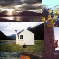
Christmas morning delivered a treat as 10 minutes down valley we found a braided crossing and negotiated the river, which was still up. We raced up to the hut (it’s a beaut) and got the fire going. The rest of Christmas day saw Forbes Hut converted to a ‘chinese laundry’ as we dried everything in our packs. We ate lots of food, read New Idea magazines dating from 1983, and slept. This went someway to making up for the hard days in the rain.
After our gruelling exit from the Landsborough, we elected to head out to Hunter Valley Station, and try for another trip. (The original plan had called for us to cross into the Ahuriri and then back to the car via the South Temple.) It was a long way down the valley and it was pretty soul destroying. One of the few highlights was the healthy growth of mistletoe near Ferguson Hut, the stands of beech were ablaze with a the rich red flowers, providing a real Christmas feel to a Christmas trip. Once we crossed Long Flat Creek we were into the Hunter Valley Station run, and we had to try and avoid disturbing large mobs of frisky bovines and below Scrubby Hut we were often dodging big bulls. To top it off, we had a five hour trudge along the 4x4 road that sidles above Lake Hawea. We were too footsore to enjoy the views. It could have been a miserable end to a good trip, but it was salvaged by the lovely couple from Christchurch with a bach at Terrace Creek. They fed us, gave us juice and then drove us to the Lake Hawea campground. It was a brilliant act of generosity, that just made the whole plod out seem a lot better.
Overall I loved the trip, it covered some gorgeous country, and the Hunter is not often visited. I couldn’t recommend heading up this valley from Lake Hawea on foot though. Splash out on a helicopter or jetboat, or even better tramp in from one of the side valleys of the Haast Pass highway (Cameron, Makarora and Wills all offer options). Studholme Saddle is hard yakka, while the crossings into the Ahuriri look okay but are a bit of a grunt. The Hopkins and Ahuriri Valleys are very reachable from Wellington as they are only a few hours from Christchurch and this can be reached on a Friday night from Wellington by plane, or by car. These ‘Ohau valleys’ offer superb tramping, without the hoards of punters that spoil Nelson Lakes and Kahurangi. No excuse for Wellington people not to get down there.
Quentin Duthie
Hannah Mcgregor
Richard Davies - Scribe